# Session 3: Becoming a Data Detective
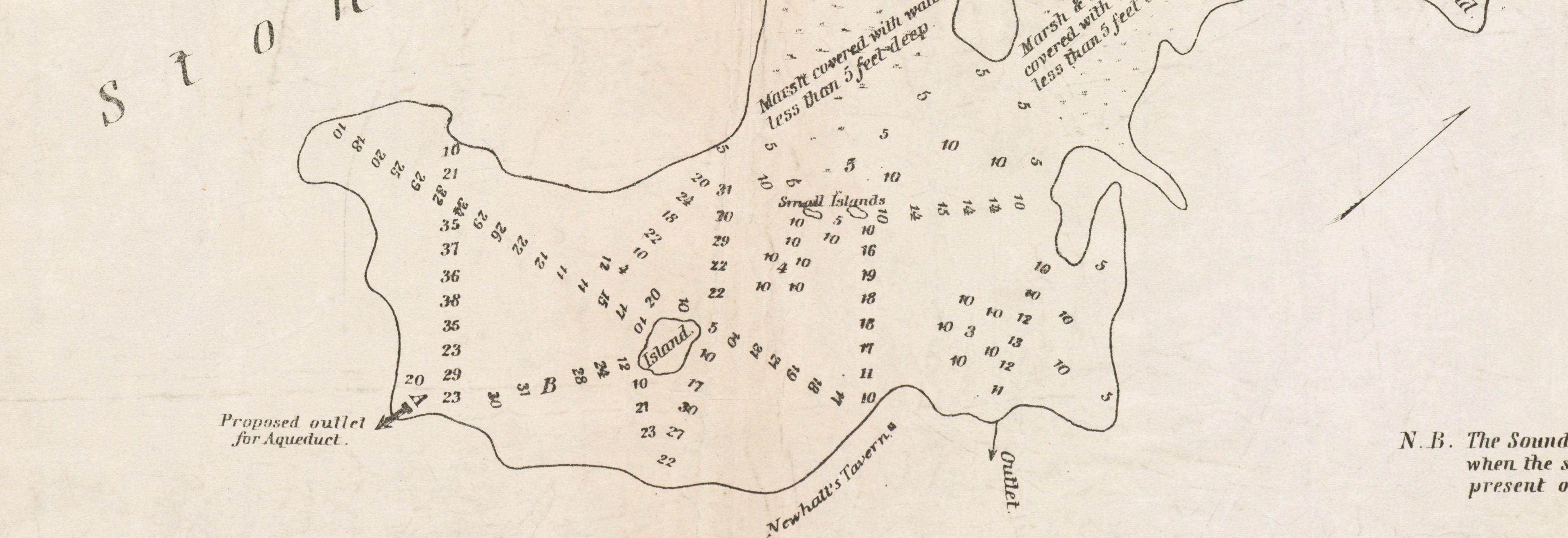
Excerpt from an 1845 chart of Spot Pond in Stoneham
Welcome back to the final session of Making Sense of Maps and Data!
In this section, we'll get you ready to become a "data detective" as you go out into the world looking for geospatial data sets and thinking about what kind of information you'll need to make a map. We'll think about how data is contextualized by the institutions who make it available, and what might happen if we miss paying attention to the descriptions that surround data. We'll practice what we might need to do when encountering a "messy" data set, and brainstorm what kinds of projects course participants might want to take on next.
# Key Questions
- What makes a dataset useful?
- In what contexts can data be used to advance an idea and when should we be wary of the limitations of using certain data?
- How should we consider the information given by the data providers?
- How can we take a messy data set and make it useful to us?
- What have we learned in this course? What projects do you want to tackle?
# Key Terms
- Metadata
- Context
- LMEC Data Portal