# Downloading Massachusetts Parcels
# Finding by location
Each Massachusetts municipality creates and maintains their own property boundary files. MassGIS has worked to standardize these files across municipalities.
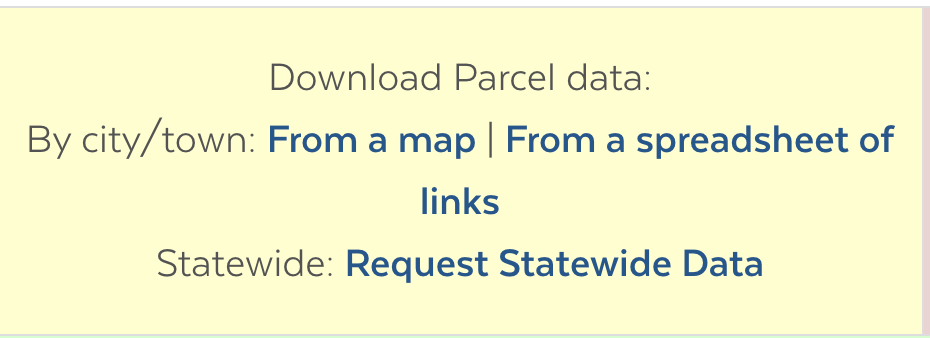
To download the data in this tutorial, learn more about this dataset and access the data codebook, please find MassGIS Data: Standardized Assessors' Parcels
On this page, there are options for finding the data. To narrow down the data to the correct location you are looking for, select the From a Map option.
You will be taken to a web app where you are presented with a data layer showing every municipality in Massachusetts.
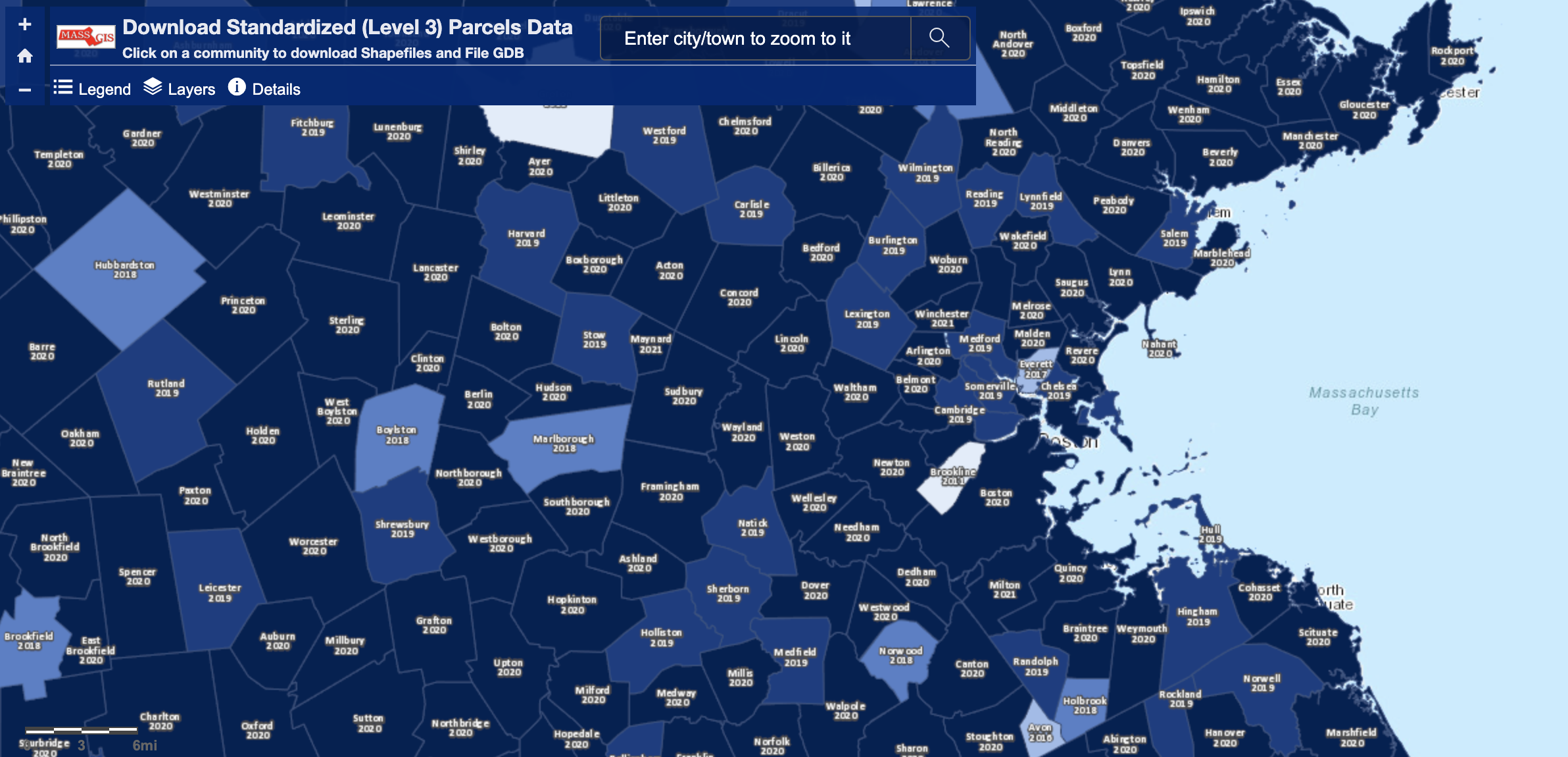
Each boundary will be labeled with the town or city name, and the most recent year that town or city's data was contributed to the standardized, open MassGIS dataset.
Zoom in to the area of interest, and select the city or town by clicking on the appropriate polygon.
# Downloading
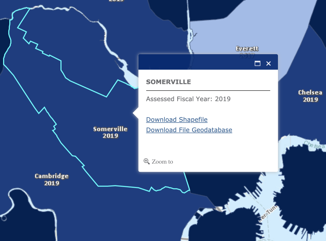
Select Download Shapefile and unzip / extract the download.
WARNING
The data inside this data folder, when unzipped will look very messy and confusing. If you are new to working with shapefiles, it may be helpful to read our Common GIS File Formats: Shapefile Guide first.
# Bringing into QGIS
In an attempt to standardize the way this data is compiled across multiple municipalities, MassGIS has broken the data in to three different layers: Miscellaneous Features, Other Legal Interests, and Tax Parcels.
We are interested in the Tax Parcels layer, so we are looking for the file that has TaxPar in the name.
From QGIS, select Layer > Add Layer > Add Vector Layer.
Source Type: File is OK as default, then click the elipses button to the right of Source Vector Datasets
Navigate to the file that contains the string TaxPar and ends in the file extension .shp. QGIS is smart enough to bring in all of the other files associated with that file, so selecting just the .shp extension is OK.
Select Add and then OK.
# Interpreting the data
To get information about any feature, you can use the QGIS Identify Tool.
To view the attribute table for the whole dataset, you can use the QGIS Attribute Table.
To learn how to interpret field names in the attribute table, and learn more about the particulars of this dataset, visit MassGIS Data: Standardized Assessors' Parcels.