# Bring BPL Atlas Tiles into QGIS
# Understanding Atlascope tiles
With Atlascope, you can digitally access our collection of historical urban atlases of the Boston area. Over one hundred layers are now available as georeferenced atlas mosaics that you can either explore and compare within our application or bring into a GIS for your own storytelling or analysis. We have also converted these mosaics into web-based tiles that anyone can access and use as data in a variety of GIS systems. This guide will walk through some of the ways to get started using these tiles in your projects.
# What are our atlas tiles?
After digitally scanning, georeferencing, and stitching together all of the plates of an atlas, we combine these into one large .tif file known as the atlas mosaic. Because the mosaic file is so large, it cannot be rendered quickly in a GIS application. For this reason, we must generate a tile cache. Tiling essentially breaks the mosaic down into a series of small .png image files for various browser zoom levels. Rather than reload the mosaic in complete detail every time you pan or scroll, the GIS will only have to load the smaller files relevant to your area of focus at your chosen zoom level. This process allows you to use layers with large amounts of data with much greater ease.
# Ways to use our atlas tiles
- As basemaps
- Bring mosaiced historical maps into your document as basemaps
- For historical comparison
- Compare data about the same geography over different years
- Digitize features
- Create your own geometric datasets from the historical imagery
- Analysis and storytelling
- Combine inferred data from atlas layers with other datasets for analysis or storytelling
# Where do these tiles live?
Another difference between a mosaic and a tile cache (or XYZ layer, as we sometimes call them, referring to the XYZ tile pyramid schema ) is how they are stored. While the mosaic file must be downloaded onto your device or an external drive in order to be accessed in a GIS, tiles are hosted at special URLs that GIS software on any computer can access. These URLs are called tile access.
# Finding and accessing BPL atlas tile layers
There are, generally speaking, two ways to find Atlascope tile access for your project. Your choice will depend on what information you are beginning your project with.
# Finding layers by atlas description
If you already know the atlas volume you wish to work with, either by the name, year or call number, you can look up the tile endpoint in our technical documentation.
Our Accessing Atlascope Data documentation contains information on how to access all underlying Atlascope data, including tiles, boundary files, and metadata records.
NOTE
This documentation page assumes prior knowledge with GIS and data tools.
You can find the atlas of your choice by sorting atlases in the Layer List by either geography or publisher, and copying the tile endpoint link. The link will look something like this:

^ Screenshot of tile endpoint example from Accessing Atlascope Data technical documentation
# Using Atlascope to find layers geographically
The "visual approach"
The names of each atlas, which often refer to a geography, e.g. East Boston, 1892 can often be deceiving. Sometimes, an atlas titled East Boston can actually contain coverage for areas in East Boston, South Boston and Roxbury. These are historical objects which reflected municipal boundaries that were actively changing during the time the atlases were created.
Atlascope solves this problem of geographic idiosyncracy in the source material by allowing you to search for layers by a precise location. If you don't already know which layers are available for your area of interest, you should start with Atlascope, rather than the layer list to find out what's available.
Zoom in to a location in Atlascope, and the menus will update with every atlas we have available for that precise location.
Engage with the year layer you are interested in by turning it on in the menu, and clicking About this map
At the bottom of each layer's About this map page is a link to the tile endpoint.
Example Atlascope layer tile link

# Using Atlascope tiles with GIS software
# Using our atlas tiles with QGIS
Copy the URL to the atlas layer you want to use by referencing the documentation or searching in Atlascope.
Open QGIS.
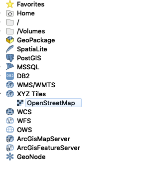
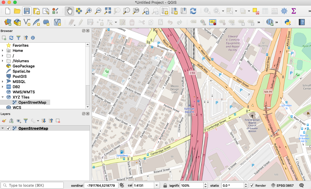
To get a reference map of real-life geography, in the Browser, which can be toggled on under
View → Panels → Browser, expand XYZ Tiles and double click OpenStreetMap

- Zoom in on the basemap in the map document to the area of interest. In this example, we will be using Somerville, MA.

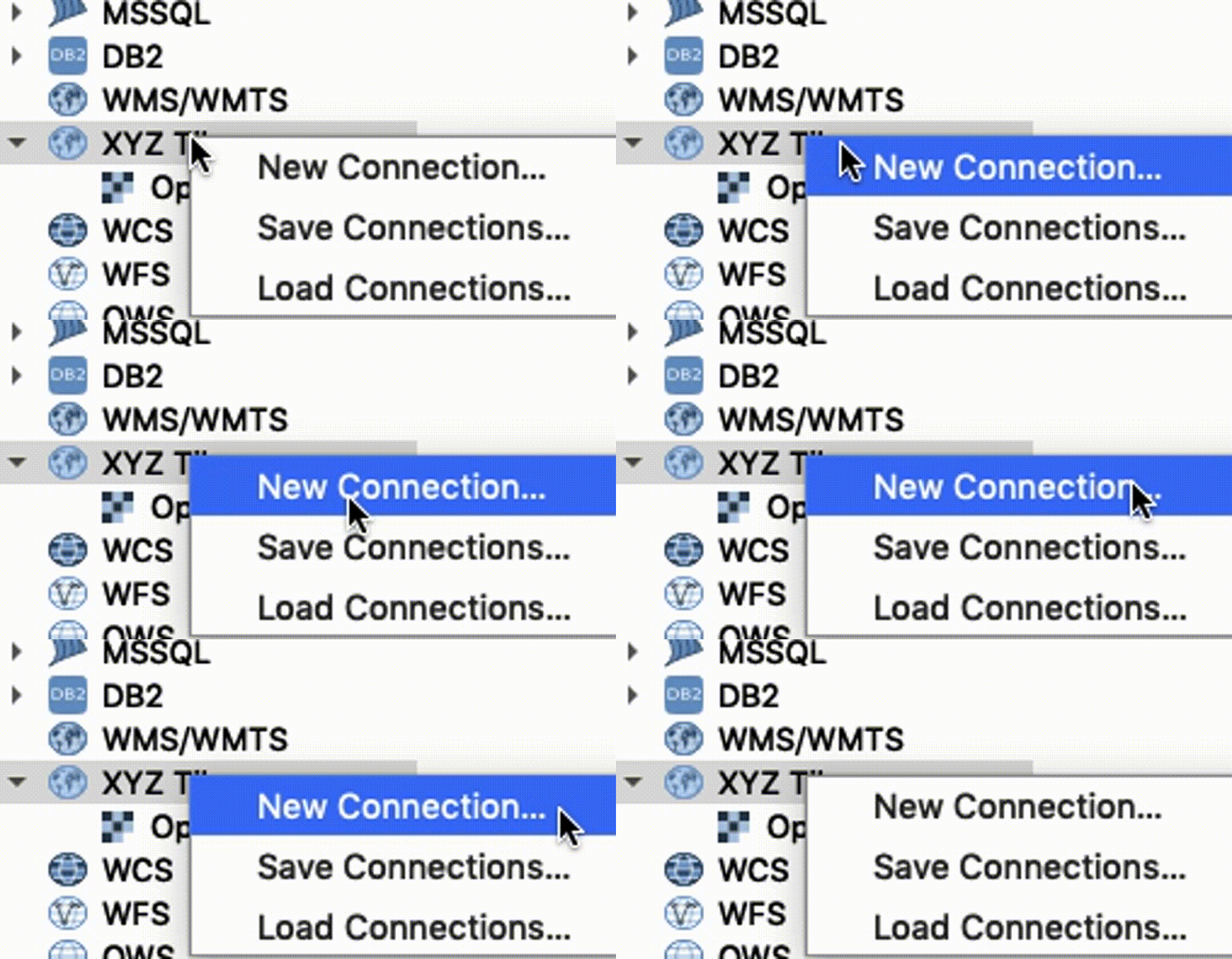
- To add the historical atlas layer, in the
Browser panel, right-click onXYZ tilesand selectNew Connection
XYZ Tiles → New Connection

- Enter the following settings
New XYZ Tile Connection Settings
Name: Whatever you want the atlas layer to be called in your map document. Geography and year could be a good name, for instance, "Somerville 1895"
URL: The URL you copied for the tile endpoint
https://s3.us-east-2.wasabisys.com/urbanatlases/{volume-identifier}/tiles/{z}/{x}/{-y}.png
Min. Zoom Level: 13
Max. Zoom Level: 20
Everything else default
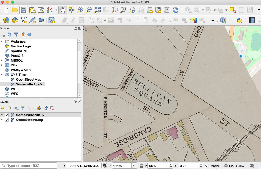
- You will now see your new tile layer as an option in the
browserunderXYZ Tiles. Double-click the new layer to add it to the document.

You can now use this layer as a basemap. You can bring in other datasets to compare it to, like other historical layers, or modern data. Alternatively, in QGIS you can use this historical layer to create your own point, line or polygon dataset by digitizing features from the historical basemap and adding attribute information to those features.
# Using our atlas tiles with ArcGIS Online
ArcGIS Online (AGOL) is one of the more popular out-of-the-box web mapping tools. With it, users can make free online web maps from many different data sources.
AGOL does allow one to bring in XYZ tilesets to display in a shareable web map. Unfortunately, AGOL does not accommodate the TMS specification our tiles were initially created in, it only allows for the XYZ specification. We are in the process of translating our Boston tiles to the XYZ pyramid schema, in order to ensure compatibility with this popular tool. While this transition process is underway, if there are particular layers you are interested in working with right now in ArcGIS Online, please let us know, and we will prioritize these tilelayers and get them formatted for you in a speedy manner. To inquire about the schema specifications for any given atlas volume, please consult our documentation, or drop us a line.
# Leaflet
If you are planning to use a Boston atlas which has not yet been converted from the TMS pyramid specification to the XYZ specification, please note that Leaflet does not accept the -y parameter present in the TMS link syntax, and you will need to format the tile definition in Leaflet in the following way, by adding the tms: true flag.
L.tileLayer(
    'https://s3.us-east-2.wasabisys.com/urbanatlases/39999059015998/tiles/{z}/{x}/{y}.png', {
        tms: true,
        attribution: 'Leventhal Map & Education Center'
    }
);
